
Nepal's Re 1 coin gets a makeover: Controversial Kalapani-Lipulekh-Limpiyadhura map removed
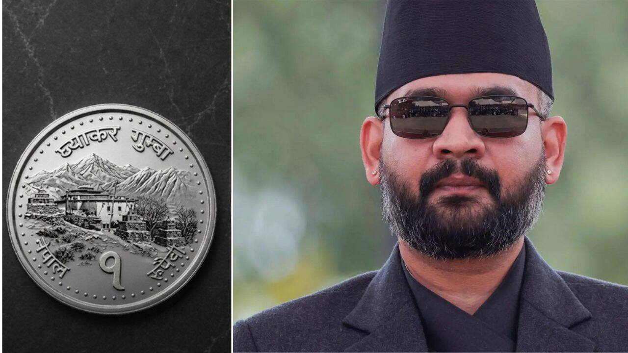
The Nepal government has approved the minting of a newly designed one-rupee coin, replacing the country's controversial map that included the disputed areas of Limpiyadhura, Lipulekh and Kalapani with the image of an ancient monastery.The decision comes years after Nepal's then KP Sharma Oli-led government introduced a new political map in 2020 showing the three disputed territories as part of Nepal, triggering a diplomatic row with India.
Nepal claims Lipulekh, Kalapani and Limpiyadhura as its territory, while India maintains that the areas belong to it.According to cabinet sources, Nepal's Council of Ministers approved the Nepal Rastra Bank's proposal on Thursday to mint redesigned one-rupee and two-rupee coins, PTI reported.As part of the redesign, the controversial political map will be removed from the one-rupee coin and replaced with the image of the Lo Ghyakar Monastery, located in Marang village in Mustang district.
The monastery is regarded as one of Nepal's oldest Buddhist monasteries.However, the two-rupee coin will continue to carry the map introduced earlier, PTI reported citing cabinet sources.The proposal is part of a broader redesign by the Nepal Rastra Bank to reduce the size and weight of coins. Bank spokesperson Guru Prasad Paudel said the new one-rupee coin will weigh 3.2 grams instead of 4 grams, while the two-rupee coin will weigh 3.8 grams instead of 5 grams.
Both coins will be made of steel instead of mixed metal and will have a steel-white colour instead of the current yellow finish.The decision has drawn criticism from senior Nepali Communist Party leader Bhim Rawal, who described it as a move against Nepal's territorial integrity."If the government led by Prime Minister Balen Shah has indeed decided to remove the map of Nepal, including Limpiyadhura, Lipulekh and Kalapani, from the one-rupee coin and replace it with the image of the Lo Ghyakar Monastery, it will constitute another serious anti-national decision and a blow to Nepal's territorial integrity," Rawal said.He also demanded that the government and the ruling Rastriya Swatantra Party immediately clarify the decision.Background of the disputeThe controversy dates back to May 2020, when Nepal's then prime minister KP Sharma Oli unveiled a new official political map incorporating Lipulekh, Kalapani and Limpiyadhura as part of Nepal.
The move came after India inaugurated a road connecting Dharchula in Uttarakhand to Lipulekh Pass, a key route for the Kailash Mansarovar pilgrimage.The three areas lie near the India-Nepal-China tri-junction and have long been disputed. Nepal argues that, under the 1816 Sugauli Treaty with British India, the Mahakali River forms the boundary between the two countries and that the disputed territories lie east of the river, making them part of Nepal.
India maintains that the boundary follows a different origin of the river and considers the areas part of Uttarakhand.The dispute has strategic significance because Lipulekh Pass provides India with an important route to Kailash Mansarovar and serves as a key vantage point for monitoring Chinese military activity along the border.
Since the 1962 India-China war, the Kalapani area has been manned by the Indo-Tibetan Border Police.Catch the latest World News and Live updates. Download the TOI app.